|
|
Post by fiona on May 8, 2011 15:44:22 GMT -5
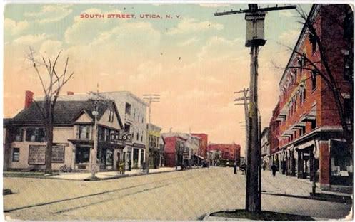
here's alooker - South Street around 1900. I may use this somewhere.  |
|
|
|
Post by fiona on May 8, 2011 15:48:49 GMT -5
see that tall building in the background, left side, south corner of West and South? That's the Chelsea, the first building put up by Northrup and Latcher. It was torn down in 1984 or so. It had deteriorated so that it was unliveable. I know it was built prior to the Genesee Flats, I think actually around1888.
|
|
|
|
Post by Dave on May 9, 2011 10:17:02 GMT -5
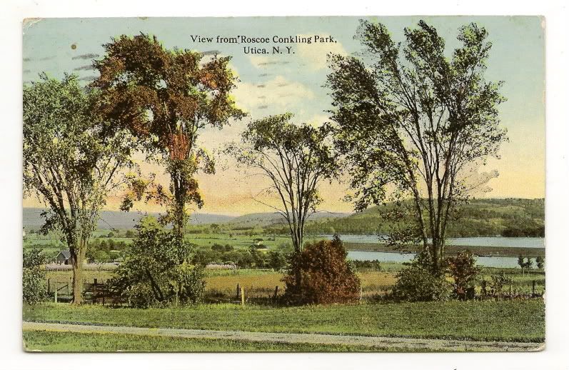
Dave: I got a lot of nice new views today by trolling around. I have a favor to ask of you, before I go on with the tour: Can you post a map of Pleasent Street, showing the egress from Roscoe Conkling Park around 1900? I do not know if Pleasent Street was so named then and I only found 1 postcard of R.C. Park dated 1909. I know the Parkway exhisted in 1909, but I need to be specific with this. It's kind of iffy, not exactly like Genesee Street which you knew what was there and when. Peace to you on this cold and gloomy Mother's Day. I've been looking for a map of the park, thinking it would have been published at the time of the dedication in 1909. I found the splash in the newspaper of 1909, but no map. I'll keep looking. Where IS the egress of the park? On Oneida St. at the entrance to the Cemetery? Or at the top of Seymour and Pleasant? Or down toward Proctor Park? Old accounts of Roscoe Conkling park say it extended from Proctor Park to Oneida St. uninterrupted. So it must have been what is today the Parkway (roads and median.) Either that or it was a strip of land along the Parkway that is today private properties. |
|
|
|
Post by Dave on May 9, 2011 12:50:57 GMT -5
Not sure if this is useful, but here is Google's overview of the Park today.  |
|
|
|
Post by fiona on May 10, 2011 19:14:48 GMT -5
OK> Thanks. I had no idea all the parks were continuous. Anyhow I think I will save this park for another tour: mabye "Parks of Old Utica" and concentrate on Oneida Square, Park Ave (Street, as it was then known,) Rutger and Chancellor Park. That should be enough. I may even take out the tour guide aspect and simply show the cards in a linear process with historical explanations. IDK just yet. All the cards are beautiful, but not all are appropriate for this 2nd chapter. And I am sure there many more yet out there that i haven't even seen.
|
|
|
|
Post by Dave on May 11, 2011 5:15:27 GMT -5
I like the Tour Guide touch.
|
|
|
|
Post by fiona on May 11, 2011 16:03:40 GMT -5
OK. Well, let me get the cards in some sort of order first. Are you cool with posting the maps within the text as inserts, once the route is organized? OK. This is the route: All meet at Oneida Square, (view sailors and soldiers statue) process over to Park Ave ( Park St.)(view no 1 firehouse) corner of Park and Eagle. (we must have a view of that somewhere), down Park St to Oneida Cty Historical building, over to Steuben Park, view First Baptist and Armory, down Rutger to Rutger Park. All stop for tea on the grounds. Up Howard to South, over South, down ? to John St, to Chancellor Park, over Bleeker to John St, view St John's Church, up John St to view sunset at Rutger Park. Does that make sense at all? Anything I left out?
|
|
|
|
Post by fiona on May 11, 2011 16:06:11 GMT -5
We will leave the intro, the glass negs, as they are and I will insert the text last. OK?
|
|
|
|
Post by fiona on May 11, 2011 16:16:51 GMT -5
just a song at twilight, when the lamps are low...  |
|
|
|
Post by Dave on May 11, 2011 16:59:26 GMT -5
Sounds good. I'll have to insert pieces of maps, since the entire route might be too large for the streets to readable. Shall I use the 1883 map to match (roughly) the post cards?
|
|
|
|
Post by fiona on May 12, 2011 13:26:59 GMT -5
Yes. Please go ahead and insert a map of Oneida Square. Yes, the 1883 map is beautiful. Then people can see the radial layout of the square where the street interesect and how it is related to the City Beautiful Movement and also the radial layouts of the streets of Paris. (the design of the city is European, as you know) the maps will give us birds eye views. Thanks again. This second phase of this project is really taking off after a slow start. Do we have any photos of NO 1 FD hanging about and if so, can you cut it up or doctor it, showing only no 1?
|
|
|
|
Post by Dave on May 12, 2011 20:57:23 GMT -5
Unfortunately, the 1883 map, done in sections, splits across sections for Oneida Square, Steuben Park and also Chancellor Park. I.e., each of these places is on the very edge of a map section. Here is the paste-up I was able to do of Oneida Square from two sections. If you think it's worth viewing, I can put it in the main "Streets" thread. So, post your photos up to the point where you want the following map and then I'll put the map in. Or do you want the map of Oneida Square to be the next post now?  |
|
|
|
Post by fiona on May 12, 2011 22:31:46 GMT -5
Yes. The map is beautiful, so put it after my last Oneida Square post, the post of the Church, please.
|
|
|
|
Post by Dave on May 12, 2011 23:09:51 GMT -5
OK. And I may touch the the maps up as we go along.
I have a similar piece of the map I put together for Steuben Park.
Where would you like that?
|
|
|
|
Post by fiona on May 13, 2011 13:10:54 GMT -5
As We move the tour into the Steuben park area, that's where we will place that map. I am not ready for it yet. I am in the process of moving stuff around right now.
|
|